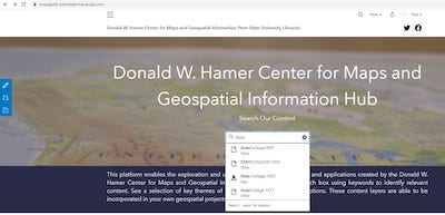
 Donald W. Hamer Center for Maps and Geospatial Information ArcGIS Hub
This ArcGIS Hub site aggregates geospatial content (feature layers, tile layers, web maps, web map applications, and story maps) in ArcGIS Online. Some key types of content relate to World War II Office of Strategic Services (OSS) Maps, Sanborn Fire Insurance Maps for State College, Altoona, and Erie PA; along with finding aids for locating Sanborn Insurance Maps.
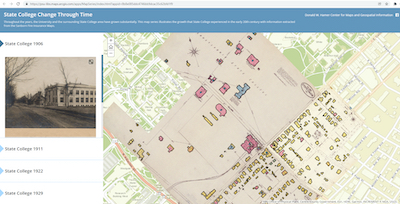 Sanborn Maps Projects
Multiple State College, PA Sanborn Fire Insurance Map projects related to historical land use, census information, and Penn State student directories have been completed by Maps and GIS Assistants.
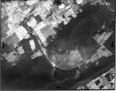 Pennsylvania Historical Aerial Photography
Multiple inventories of historic aerial photographs of PA have occurred to inform availability. In addition, enhancements have been made to indices of historic aerial photos.
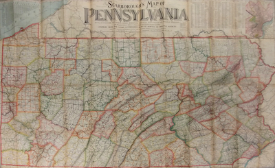
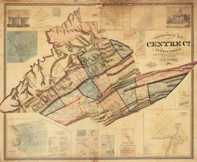 Pennsylvania Historical County Atlases
Based on the Historical Maps of Pennsylvania website, links were added to freely available scans from the Library of Congress, the David Rumsey Collection, Penn State University Libraries, the Pennsylvania State Archives, the Free Library of Philadelphia and others.
 Pennsylvania Historic Base Map Layers
Inventory of available PA historic base map layers in 10-year intervals between 1900 and 2019, and at 50-year intervals between 1800 and 1899.
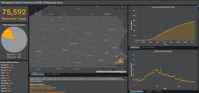 Pennsylvania Novel Coronavirus Dashboard (March 2020-Summer 2020)
Background on the PA Novel Coronavirus Dashboard from our initial application using data from the PA Dept. of Health.
 Maps and Geospatial Web Content Institutional Review
This project gathered academic library website content related to maps and geospatial guides, collections, and services for review in order to create enhancement to current Penn State maps and geospatial LibGuide and additional website content.
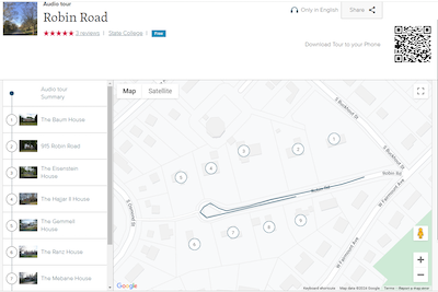 Walking Tour of the Robin Road Neighborhood (State College, PA)
This tour can be access through a browser or the izi.Travel Audio Tours app. This tour was created in partnership between the Donald W. Hamer Center for Maps and Geospatial Information and the Architecture and Landscape Architecture Library.
Geospatial Data Electronic Inventory
Through a geospatial electronic media inventory, items were inventoried to provide an assessment of their usability. Through a review of electronic resources (subscription products), products were assessed for their map and geospatial content.
Mid State Trail Guide 13th Edition Elevation Profiles
Twenty updated elevation profiles were published in 2018 as part of the 13th edition of the Guide to Pennsylvania Mid State Trail, Mid State Trail Association, Inc.
American Archives and Climate Change: Risks and Adaptation
This project investigates the spatial variability of climate risks to libraries and archives and detail how this may change in the future under expected climate change.
Accuracy Assessment of Sanborn Fire Insurance Maps
This project examines the accuracy of Sanborn Fire Insurance maps.
Maps and GIS Diversity Resources
This project focuses on the location and collection of maps and GIS resources, data, and sample projects related to diversity themes. The compilation of these resources and content occurred during the remove work period in late Spring 2020 by Maps and GIS Assistants.
BTAA Geoportal
A collaborative project across Big Ten Academic Alliance schools to assemble digitized map and geospatial metadata in one place with geographic and keyword searching.